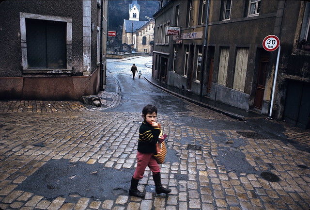
Pfaffenthal downtown district
In 1972, that street was one of the main access roads of the Pfaffenthal. Nowadays a modern elevator was built which makes the way back up to the city center much quicker and easier for Pfaffenthal inhabitants – and the Pfaffenthal district more accessible for tourists.
The three towers
Visit this page to see the "three towers". These photos show the inside walls of the three towers monument, as in "inside the fortress" — Google Street view.
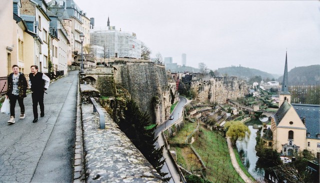
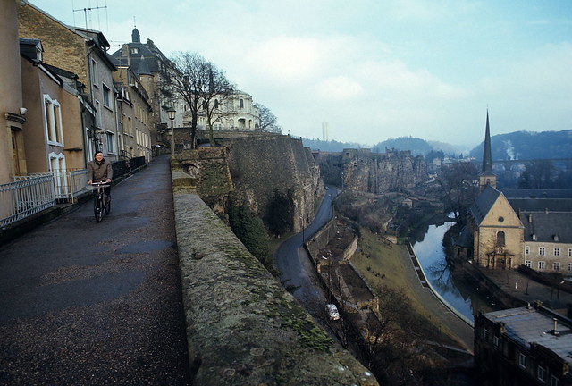
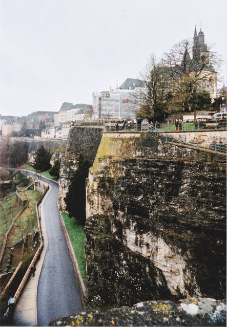
Chemin de la corniche
Another picture taken from the chemin de la corniche which oversees the Grund district and Alzette river.
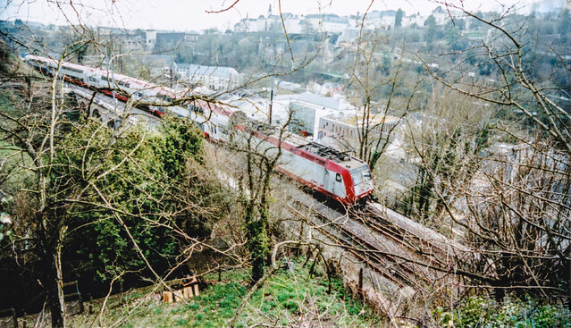
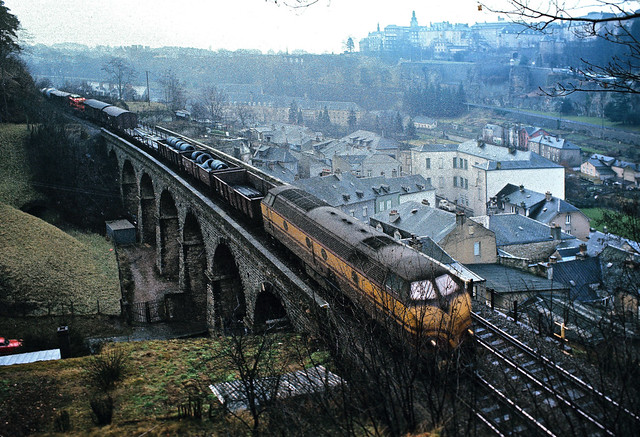
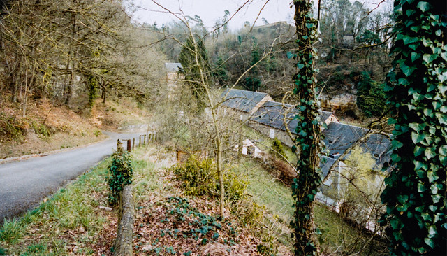
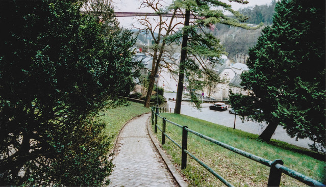
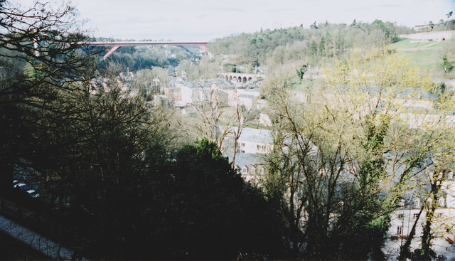
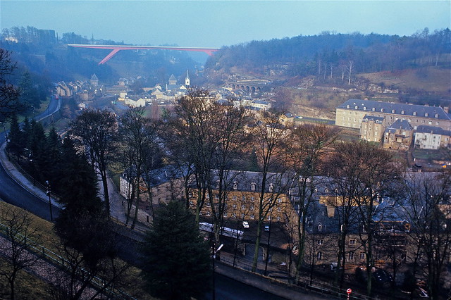
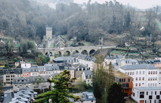
Pfaffenthal train bridge and Hiel
The Pfaffenthal train bridge, which has its dedicated web page. Underneath, the little way that leads from the Hiel (rue des Trois Glands) to the photo spot.
Neumünster abbey, Alzette river and Bockfiels
When the 1972 photo was taken, the former abbey was being used as a prison. Nowadays, Neimënster is a cultural center. A detailed history can be found on their website. The photo was taken from the chemin de la corniche.
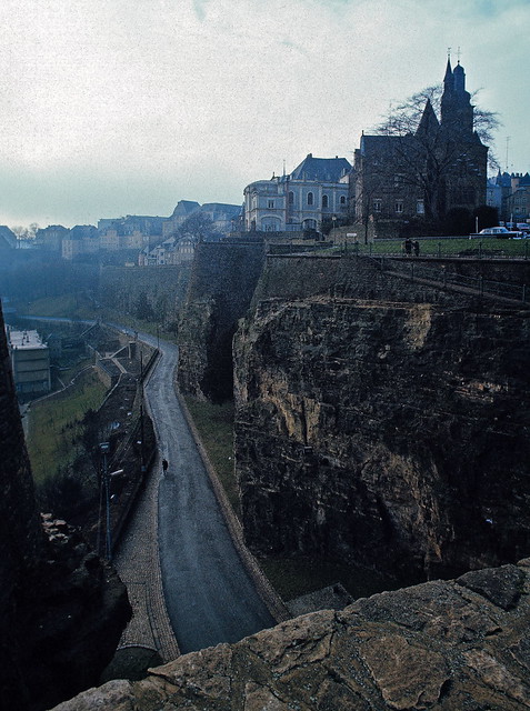
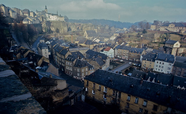
Bockfiels south side and St. Michael Church
This picture was taken from the Bockfiels, the rock over which the historical entrance of the fortress was built – and inside which are the "Kasematten" tunnels. You can see the St. Michael church, one of the first buildings of the city. Google street view.
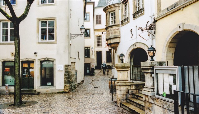
Fëschmaart square
The Fëschmaart, fish market in Luxembourgish, an important place at the time of the fortress. It is nowadays a beloved nightlife area with many pubs. Read more about the fish market square on the website of Luxembourg City.
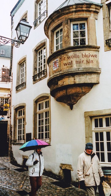
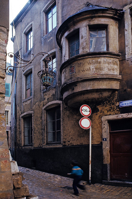
Rue de la Loge window
This building in the rue de la Loge street is a much photographed spot located on the fish market. The inscription Mir wëlle bleiwe wat mir sinn (We want to remain what we are) is a Luxembourgish motto.
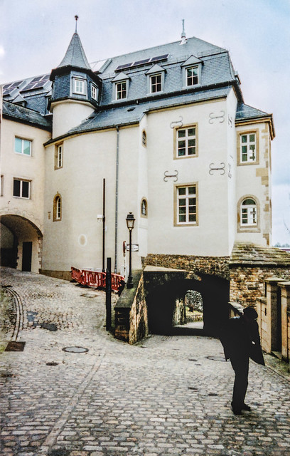
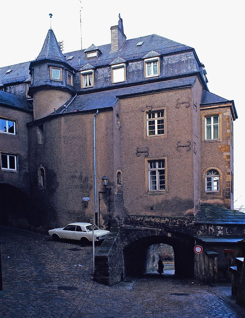
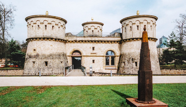
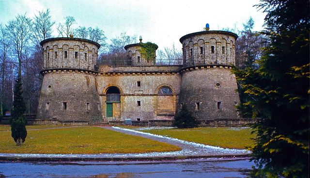
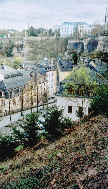
Fort Thüngen – Dräi Eechelen
The area of Luxembourg City in which Fort Thüngen, also called Dräi Eechelen (three acorns), is located was only made easily accessible by car after 1965 through the construction of a bridge. Therefore, on the 1972 photo, the building was probably still empty and dilapidated. It nowadays hosts the museum of the fortress.
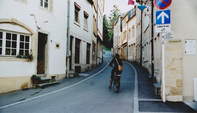
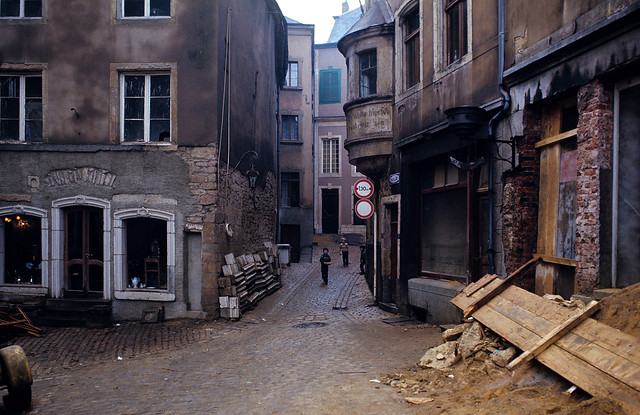
Walking down to Pfaffenthal
A small path connecting the upper city to the downtown Pfaffenthal quarters. Not much has changed here in 45 years.
The "Roude Pëtz" square
The Roude Pëtz (red well) square and the rue Genistre which leads to the Place d'Armes. Not visible on the photo, the well with a sculpture representing the Hämmelsmarsch, a Luxembourgish musical tradition which made it to the USA. Google street view.
Neumünster abbey
On the 1972 image you can still see the large prison wall where nowadays the large outdoor court hosts concerts and other cultural events.
On the horizon, the Rham Plateau. Old military buildings from the 15th–17th century, now completely renovated and modernised – used as nursing and retirement homes.
The photos were taken from the Bockfiels, on top of the Kasematten.
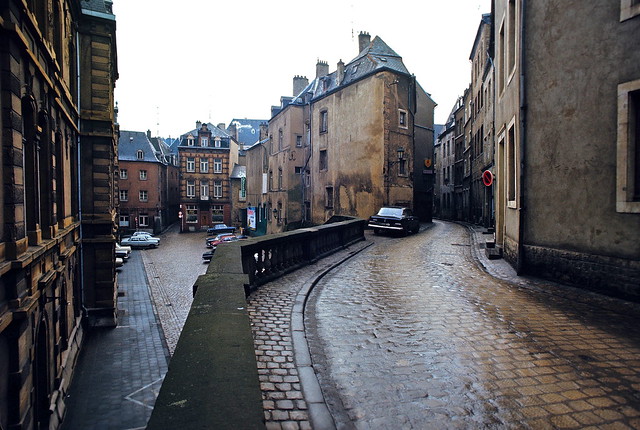
Former "palais de justice" and rue du Nord
The ancien palais de justice used to host the national justice courts. The courts moved to a new location nearby in 2008. On the right, the rue du Nord, which is also visible from the other end on another photo in this collection. Google street view.
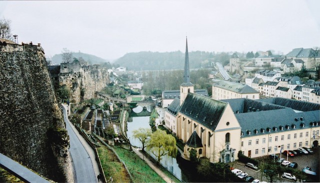
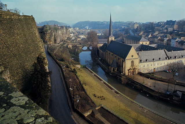
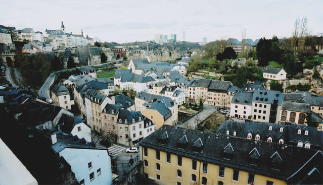
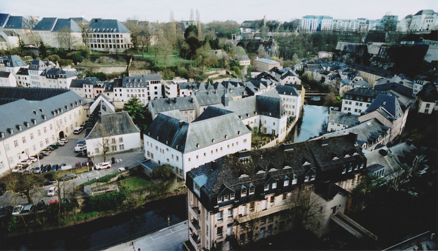
Grund, Bockfiels, Kirchberg on the horizon
Many districts of Luxembourg are visible on these images. The downtown Grund along the Alzette river, the old parts of the city with the St. Michael church in the horizon (left), and the Kirchberg (horizon center) – the more recent business district of Luxembourg which in 1972 hosted only one single tall building.
Montée du Grund
The Montée du Grund (street) starts in the Grund district, then splits to go either to the plateau Saint-Esprit or towards the Bockfiels / uptown old city. Google street view from the Montée du Grund.
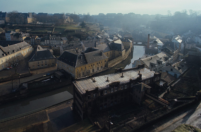
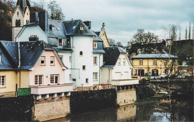
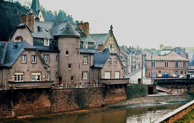
Downtown Grund district and the Alzette River
The building in the center of the images is the hospice Saint Jean (Wikipedia). It served as a hospital, then as a women's prison until 1984. Since 1996 the National Museum of Natural History occupies the hospice Saint Jean and neighbouring buildings.
The photo was taken from the chemin de la corniche.
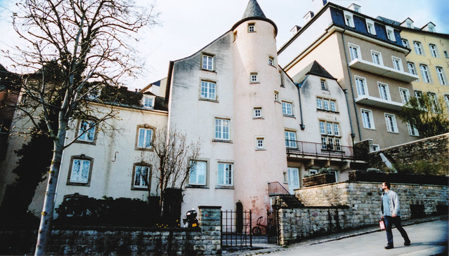
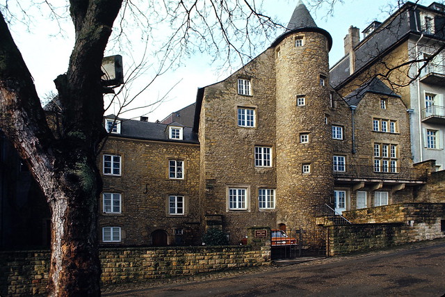
Maison de Cassal
From the same spot as the previous photo was taken on the chemin de la corniche, turn around and you will see the back of the Maison Cassal; the front entrance is in the street behind – the Breedewee / rue Large. The old house that belonged to local industrial entrepreneurs currently hosts the media & communication offices of the state ministry.
View from the Bockfiels
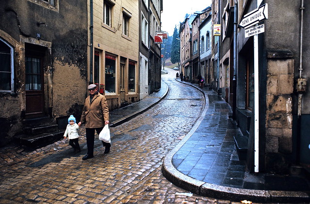
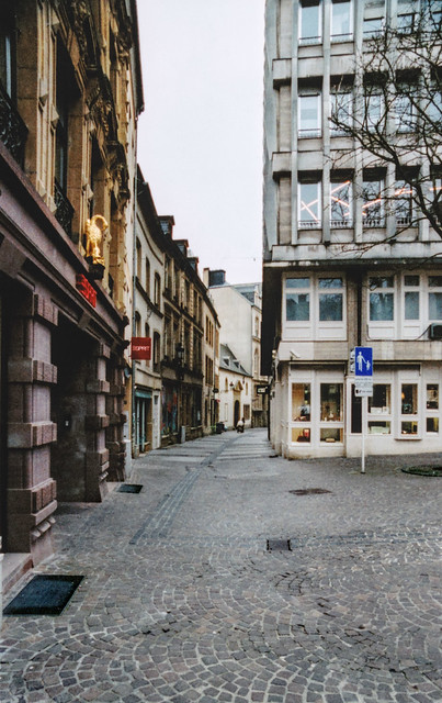
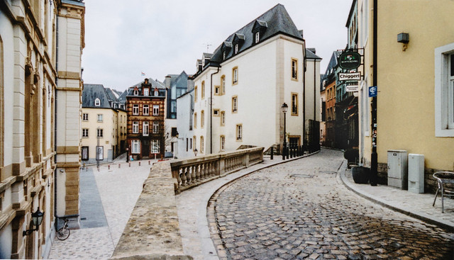
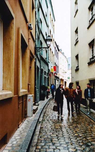
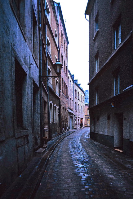
Rue du Nord, uptown Luxembourg
The street looks pretty much unchanged. It is nowadays a much appreciated nightlife and after-work spot with pubs and restaurants. Google street view.
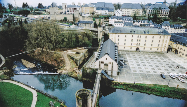
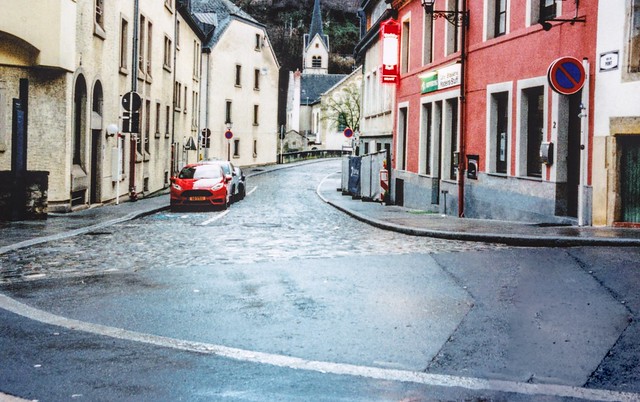
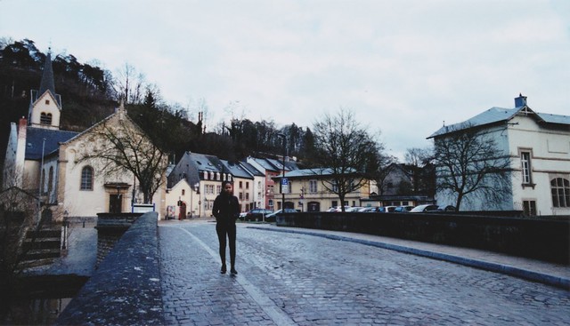
Rue du pont and Pfaffenthal church
The Pfaffenthal bridge and church.
Alzette river and red bridge
The pictures were taken from the bridge which crosses the Alzette river in the downtown Pfaffenthal district.
Alzette river, Pfaffenthal
Same houses as on the previous photos but taken from a pedestrian crossway above the Alzette river, which connects the two Vauban towers.
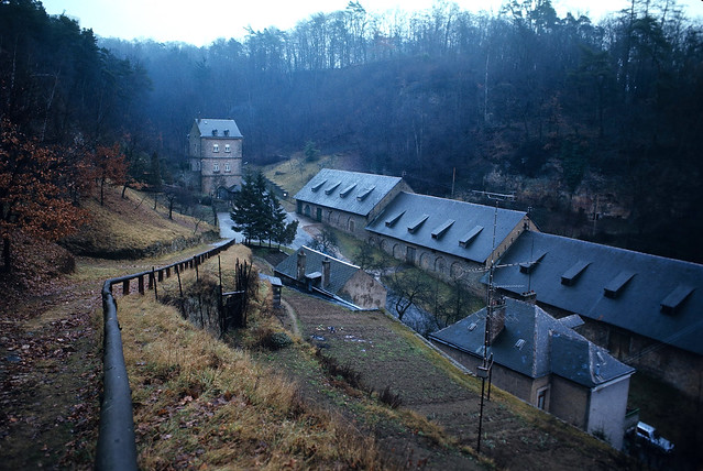
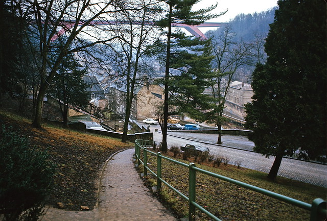
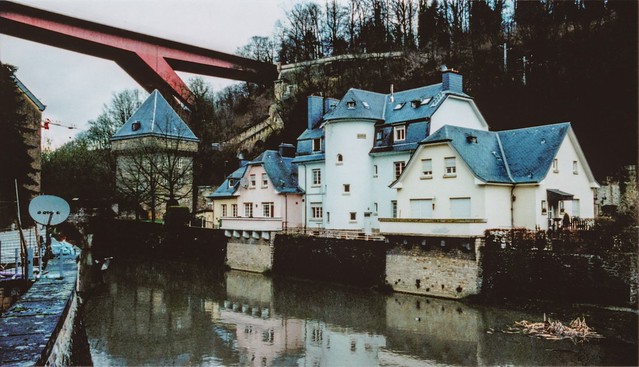
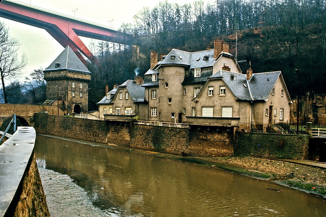
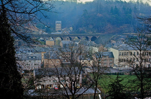
Porte du Grünewald and train bridge
As I was looking for the exact spot where this photo was taken in 1972, I realised that it doesn't exist anymore. A tunnel was built in the 1980s and the original photo spot is probably located in that tunnel 🙂 — but I managed to take a photo very close to it.
On the pictures: the Hiel, which is the name of the entrance place to the Grünewald forest in the back of the photo. A train bridge and parts of the Pfaffenthal district.
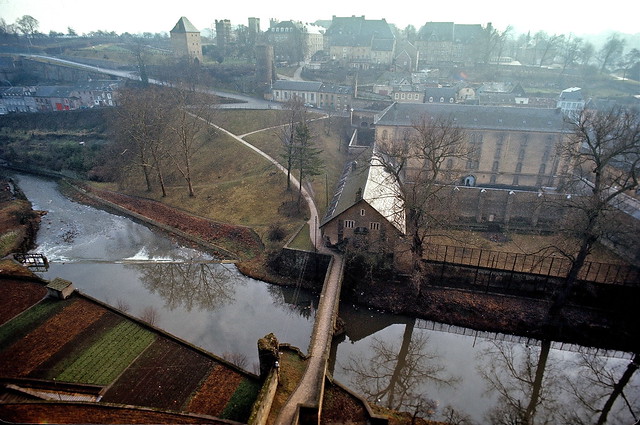
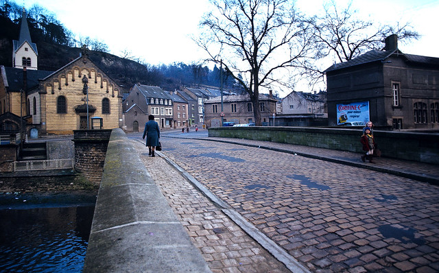
Rue du pont, Pfaffenthal
The Pfaffenthal bridge and church. The street name is rue du pont.
FAQs
- Why do the old photos look sharper? Yes, the newer photos are lower quality; I took them with expired APS film rolls, which are anyway lower quality than the 35mm used for the 1972 photos.
- Will there be more? I do not plan to add new photos.